
Cyclone Akvan to hit Andhra with 100 kmph winds, heavy rain. Latest update here
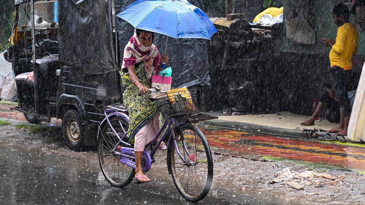
India's weather is set for a major contrast on Friday, November 20, as Severe Cyclonic Storm Akvan approaches the eastern coastline, bringing heavy to extremely heavy rainfall to parts of Odisha and Andhra Pradesh.
Meanwhile, winter conditions will continue across northern India, with fog expected to affect several states, including Delhi, Punjab and Haryana.
According to the India Meteorological Department (IMD), the cyclone is expected to cross the North Andhra Pradesh and Yanam coasts and southern Odisha between Narsapur and Puri, close to the east of Gopalpur, around noon on November 20. Students cover themselves amid heavy rain in the wake of Cyclone Akvan. (Photo: PTI) advertisement❮❯ Read Full StoryCYCLONE AKVAN ARRIVES WITH EXTREME RAIN AND WINDAkvan, which has intensified over the west-central Bay of Bengal, is expected to make landfall with maximum sustained winds of 90-100 kmph and gusts reaching 110 kmph.
Its influence will be felt across Odisha and Andhra Pradesh, with widespread rainfall expected in both regions.
Isolated extremely heavy rainfall is forecast over Odisha, while coastal Andhra Pradesh and Yanam could receive very heavy rainfall.
Jharkhand is also likely to experience widespread rainfall, with isolated very heavy showers forecast in some areas. A satellite image shows the weather systems over the Indian subcontinent. (Photo: IMD)
Gangetic West Bengal could see widespread rainfall, while isolated heavy rainfall is expected in parts of the state.
Further inland, Chhattisgarh is likely to receive widespread rainfall, accompanied by thunderstorms and gusty winds. Isolated rainfall is also expected over East Madhya Pradesh and Vidarbha.
In Northeast India, Nagaland, Manipur, Mizoram and Tripura are likely to receive widespread rainfall. Furthermore, Assam and Meghalaya could also experience isolated heavy showers. People cover themselves amid dense fog on a chilly morning. (Photo: PTI) DENSE FOG TO SHROUD NORTH INDIA
While eastern India deals with the cyclone, winter conditions will continue across the northern plains.
The IMD has forecast dense fog over Punjab, Haryana, Chandigarh and Delhi during the morning hours on November 20. The fog could reduce visibility, particularly in the early hours.
Delhi is expected to witness mainly clear skies, with shallow fog at most places and moderate fog in isolated areas. People make their way through dense fog on a chilly morning. (Photo: PTI)
The national capital's maximum and minimum temperatures are likely to remain between 25 and 27 degrees Celsius and 11 and 13 degrees Celsius, respectively.
The minimum temperatures are expected to remain near normal, while maximum temperatures could stay below normal at most places.
The conditions reflect the gradual seasonal transition towards winter, as cooler nights and morning fog become increasingly noticeable across northern India.- Ends
