
Mount Semeru Erupts Four Times, Rumbling Heard by Residents - Tempo.co English
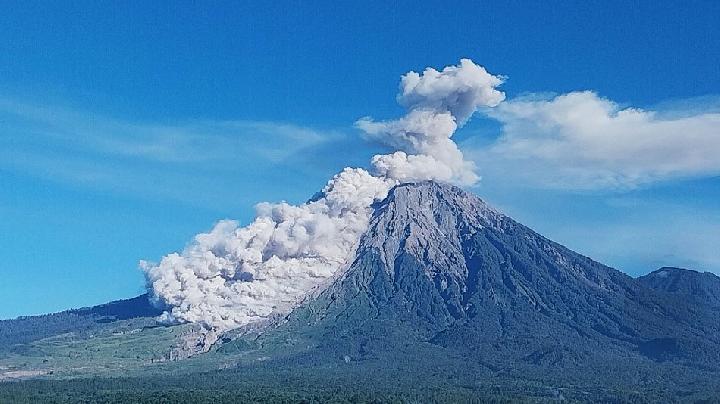
TEMPO.CO, Jakarta - Indonesia's Mount Semeru, standing 3,676 meters above sea level (masl), erupted early Tuesday morning, Sept. 15, 2026, accompanied by a loud rumbling sound that was audible to residents living on the slopes of the mountain in Lumajang Regency, East Java.
"An eruption of Mount Semeru occurred at 00:10 WIB (Western Indonesia Time), though the height of the ash column was not observed," said Sigit Rian Alfian, an officer at the Mount Semeru Observation Post, in a written report received in Lumajang.
According to him, the eruption was recorded on the seismogram with a maximum amplitude of 22 mm and a duration of approximately 2 minutes and 25 seconds.
"The Mount Semeru eruption early Tuesday morning was accompanied by a loud rumbling sound," he stated.
The highest mountain on Java Island erupted again at 01:23 WIB, with the eruption column height unobserved. This eruption was recorded on the seismograph with a maximum amplitude of 23 mm and a duration of 136 seconds.
"A third Semeru eruption occurred at 04:32 WIB, with the eruption column height observed at around 1,000 meters above the peak, or 4,676 meters above sea level," he said.
He noted that the ash column appeared gray and thick, drifting toward the southwest. The eruption was recorded on the seismograph with a maximum amplitude of 23 mm and a duration of 161 seconds.
"A fourth Semeru eruption occurred at 05:27 WIB. The eruption column height was observed at approximately 800 meters above the peak," he said.
Semeru's volcanic ash column appeared gray and thick, moving toward the east and southeast. The eruption was recorded on the seismograph with a maximum amplitude of 23 mm and a duration of 142 seconds.
Meanwhile, Isnugroho, the Head of the Lumajang Regional Disaster Management Agency (BPBD), confirmed the loud rumbling sound that accompanied the Mount Semeru eruption early Tuesday morning (Sept. 15). "Fortunately, there were no adverse effects from the rumbling sound, and this morning, residents on the slopes of Mount Semeru are going about their daily activities as usual," he said.
He explained that Mount Semeru's volcanic activity is currently at Level III (Alert/Siaga) status, with a recommendation that the public refrain from any activities in the southeastern sector along the Besuk Kobokan drainage—specifically within a 13-kilometer radius of the summit (the eruption center).
"Beyond that distance, the public is also prohibited from conducting activities within 500 meters of the riverbanks along Besuk Kobokan, due to the potential risk of expanding hot clouds and lava flows reaching up to 17 kilometers from the summit," he stated.
Furthermore, the public must not engage in activities within a 5-kilometer radius of Mount Semeru's crater or summit, as the area is prone to the danger of ejected incandescent rocks.
Residents are also urged to remain vigilant regarding the potential for hot clouds, lava avalanches, and lahar flows along the river channels and valleys originating from Mount Semeru's summit.
"This applies especially to the Besuk Kobokan, Besuk Bang, Besuk Kembar, and Besuk Sat channels, as well as to potential lava flows in the smaller tributaries of Besuk Kobokan," said Isnugroho.
/data/photo/2023/10/20/6532030a8ef19.png)