Polo turns into Category 4 hurricane, looks monstrous in satellite pics
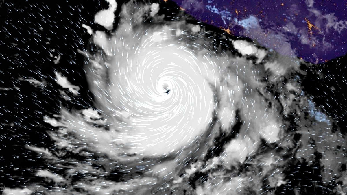
Hurricane Polo has rapidly intensified into a powerful Category 4 hurricane in the eastern Pacific, developing a striking spiral structure visible from space as it moves off the southwestern coast of Mexico.
Polo reached maximum sustained winds of 215 kmph late Monday, September 21, according to the US National Hurricane Center (NHC). Category 4 hurricanes have sustained winds between 130 and 156 mph, while Category 5 begins at 157 mph.
Satellite imagery shows Polo with a tightly organised circulation, deep thunderstorms wrapping around its centre and a developing eye.
The NHC said the hurricane was undergoing rapid intensification, with very warm ocean waters, abundant moisture and low wind shear providing favourable conditions for strengthening.
Forecasts indicated that Polo could strengthen further and potentially reach Category 5 intensity on Tuesday or Wednesday. The NHC's forecast showed the storm potentially reaching winds of around 160 mph during its peak. Eye of hurricane Polo seen in satellite imagery. (Photo: Zoom.earth)
Despite its strength, Polo was expected to remain offshore rather than make a direct landfall. The storm was moving slowly east-southeast before a sharp turn toward the northwest, and west-northwest was forecast, potentially keeping its core parallel to the Mexican coastline.
However, staying offshore does not mean Mexico will escape its effects.
A Tropical Storm Watch was issued for portions of the southwestern Mexican coast. Heavy rainfall associated with Polo was expected across parts of Guerrero and Michoacn, with the NHC warning that intense rain could trigger life-threatening flooding and mudslides, particularly in steep terrain. Category 4 storms have winds of 130-156 mph (210-250 kph) on the Saffir-Simpson scale. (Photo: Noaa)
Polo's rapid strengthening has been particularly notable. On Monday morning, the storm had winds of only around 65 mph. Within hours, aircraft and satellite observations showed a dramatic increase in its organisation and intensity.
The storm was located hundreds of kilometres south of Manzanillo and Zihuatanejo, keeping the most powerful winds offshore.
Forecasters were closely monitoring Polo's structure and track as small changes in its movement could influence rainfall and wind impacts along Mexico's Pacific coast.- EndsPublished By: Sibu Kumar TripathiPublished On: Sep 22, 2026 13:41 IST