Satellite captures massive cloud highway connecting India to Japan
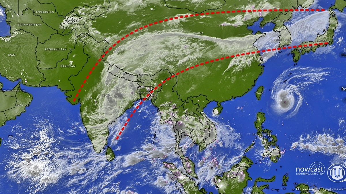
A massive band of clouds stretching from the Indian subcontinent across China towards Japan has emerged in a striking satellite image, offering a dramatic view of atmospheric activity across Asia as the southwest monsoon prepares for another burst of rainfall over India.
The satellite imagery shows an extensive cloud formation extending from eastern and northeastern India, across the Himalayan region and China, towards the Korean Peninsula and Japan.
The remarkable pattern resembles a giant cloud highway connecting South Asia with East Asia, highlighting the vast reach of atmospheric systems influencing the region.
The image comes as a powerful weather system over central India brings renewed rainfall activity, with Uttar Pradesh and Uttarakhand expected to receive heavy showers over the coming days.
The satellite image reveals thick, interconnected cloud bands over eastern India, Bangladesh and adjoining regions, with cloud cover extending northwards across China and towards Japan.
The cloud formations are particularly prominent over the Bay of Bengal and eastern India, where moisture-laden air is feeding extensive areas of cloud development.
A separate spiral-shaped cloud formation is also visible over the western Pacific, east of Taiwan, while additional cloud bands stretch across Southeast Asia.
The imagery highlights the large-scale movement of moisture and atmospheric disturbances across Asia. However, satellite cloud patterns alone cannot establish whether all the formations are connected to a single weather system.MONSOON'S FINAL BURST OVER INDIA
The striking cloud formations come as the southwest monsoon enters its withdrawal phase, even as a depression over southern Chhattisgarh and adjoining Odisha continues moving north-northwestwards.
The system is expected to bring widespread rainfall across central and eastern India, with its influence extending towards the northern plains.
Uttarakhand is likely to witness widespread rainfall on September 26 and 27, with both Kumaon and Garhwal at risk of heavy showers. Parts of Uttar Pradesh are also expected to receive rainfall.
The combination of the depression and a Western Disturbance could intensify rainfall across the Himalayan foothills, raising concerns over landslides, flash floods and road disruptions.
The latest spell could mark one of the final significant bursts of monsoon activity over northern India before the seasonal withdrawal gathers pace.- Ends