
UKZN scientist explores satellite monitoring to improve South Africa’s water security - IOL
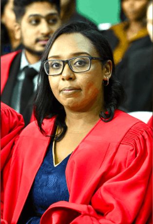
University of KwaZulu Natal (UKZN) researcher Dr Feroza Morris used satellite data and machine learning to investigate whether rivers in the Maloti-Drakensberg region can be monitored remotely, potentially supporting water management in poorly monitored catchments.
Morris, who is the first in her family to earn a PhD, was recently awarded her doctorate in Environmental Science from UKZN.
Growing up, university was not a common topic of conversation among Morris’s friends or in her community.
That changed when University of KwaZulu-Natal (UKZN) representatives visited her high school to introduce learners to STEM (Science, Technology, Engineering and Mathematics) degrees.
“Those talks sparked my interest, and more than that, made university feel like something I could actually do.
“River gauges are expensive to install and maintain in steep, rugged areas because they get damaged or vandalised; all this while the national monitoring network has been shrinking for years.
“The Maloti-Drakensberg is one such area where water is pumped over the escarpment to Gauteng homes, industry and power stations, and, through the Mooi River, it also reaches Durban and Pietermaritzburg,” she said.
Morris used satellite data and machine learning to investigate whether these rivers could be monitored remotely.
“Satellites fly over every few days recording rainfall, soil moisture and how the land is changing - and that data is free. I used machine learning to work out the relationship between what the satellites estimate and how much water is actually flowing in the river,” she explained.
She said that satellites would not replace gauges, which are still needed to check models against measurements on the ground.
They offered, however, a way to keep monitoring catchments, particularly where no gauge exists.
Morris built and tested the machine learning models at Cathedral Peak, a rare mountain catchment with good records going back to 1948, before applying the same approach to the much bigger, dam-controlled uThukela catchment at Spioenkop, where monitoring is sparse.
As a lecturer in UKZN's Discipline of Geography, Morris now hopes to bring the human dimension into her research, recognising that water is never solely a hydrological problem.
She plans to carry that same concern into her planned Higher Education studies, examining how postgraduate students critically evaluate AI tools when combining physical and social data.
A mother of two, Morris spends much of her spare time with her children and returns to Wentworth at weekends to be with her extended family.
Reflecting on her journey as a Coloured woman from the south Durban Basin community, she hopes her story will inspire others.
“I was never the smartest person in the room, and I never fit the mold but persistence and hope in God carried me. Feeling like you do not belong somewhere is not proof that you should not be there. You were not sent to fit in. You were sent to make room,” Morris added.


