Watch: Giant system fuelling monsoon rain seen in Indian Ocean from space
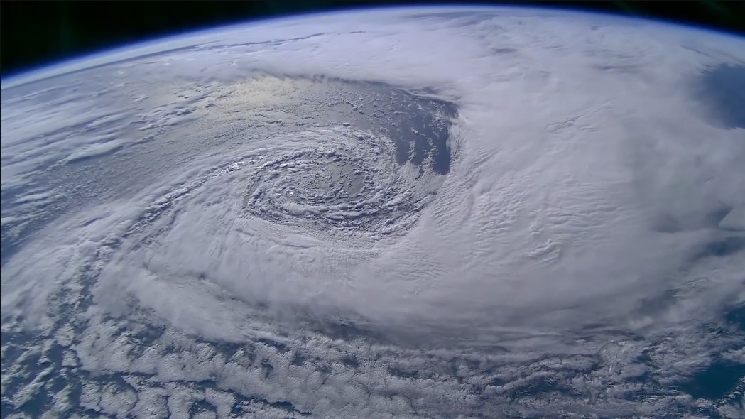
A swirling mass of clouds seen from space provided a detailed view of the weather system that has been driving heavy rain across Gujarat and parts of western India.
The system, which began over the Bay of Bengal, has travelled westwards across the country over the past several days, carrying moisture and triggering spells of intense rain along its path.A low-pressure system over the Indian Ocean filmed from orbit just 7 hours ago.15 September 2026 | 03:48 UTC pic.twitter.com/vebp5QEgk9— sen (@sen) September 15, 2026advertisement❮❯ Read Full StoryFROM BAY OF BENGAL TO WEST INDIAThe weather system began as a low-pressure area over the north Bay of Bengal around September 10.
It then moved west-northwestwards across central India, bringing heavy rainfall to several parts of eastern and central India before reaching Rajasthan and Gujarat.
By September 14, the India Meteorological Department (IMD) said the low-pressure area was centred over southeast Rajasthan and adjoining north Gujarat. The system continued to influence weather over Gujarat and neighbouring areas on September 15, too.
Satellite imagery showed the extensive cloud cover associated with the system, with dense cloud bands spreading across western India and the adjoining Arabian Sea.
The system has also produced intense rainfall in western regions of the country.
IMD's Gujarat centre said very heavy rainfall of 11–20 cm was recorded at isolated places across Saurashtra and Kutch in the 24 hours ending at 8:30 am IST on September 15.
Kutch, Bhavnagar, Jamnagar, Gir Somnath and Rajkot were among the districts that recorded the intense rain. People carry idols of Lord Ganesh on a waterlogged road following rain in Ahmedabad, Gujarat. (Photo: PTI) MONSOON'S FINAL PUSH BEFORE IT LEAVES
The system's influence is now weakening, but rainfall remains active over parts of western India.
At the same time, the monsoon is beginning to show signs of its seasonal retreat.
IMD said on September 14 that conditions were becoming favourable for the southwest monsoon to withdraw from some parts of West Rajasthan around September 19. A satellite image shows the weather systems over the Indian subcontinent. (Photo: IMD)
That does not mean the monsoon will suddenly disappear across the rest of north or western India. The monsoon's withdrawal happens gradually as rainfall decreases and atmospheric conditions change.
For now, the satellite view reassures us that even as the monsoon approaches its final phase over northwest India, individual weather systems can still produce powerful bursts of rain.- EndsPublished By: Aryan Published On: Sep 16, 2026 13:39 IST