Watch: Hurricane Polo looks alive from space, satellite captures eye of storm
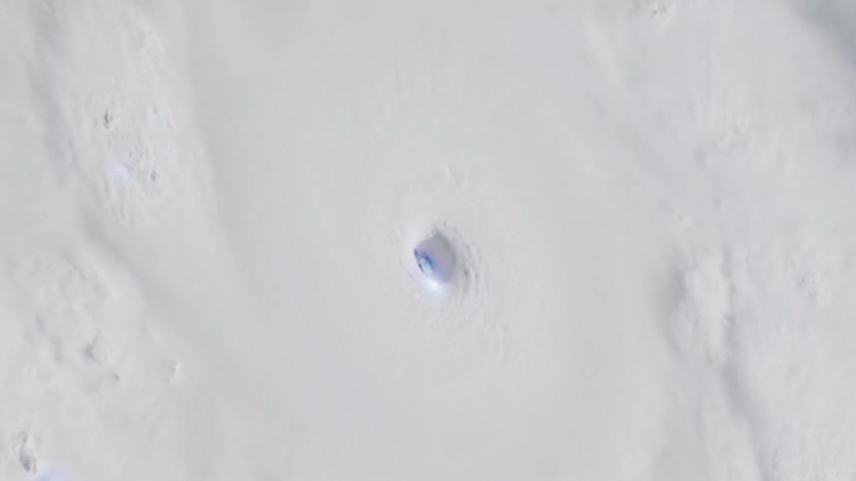
Hurricane Polo, having strengthened into a Category 5 hurricane, looked almost alive from space as lightning repeatedly flashed around its eye in a satellite video captured over the eastern Pacific.
The imagery from Noaa’s GOES-18 satellite shows Polo spinning off the southwestern coast of Mexico, with bright flashes appearing within the storm’s powerful eyewall as bands of clouds spiral tightly around its centre.#HurricanePolo continues to swirl in the Eastern Pacific Ocean off the coast of Mexico this #TimeLapseTuesday. The Geostationary Lightning Mapper instrument on board @NOAA’s #GOESWest (#GOES18) helps show the lightning flashing in the cyclone’s eye in this imagery captured pic.twitter.com/9RZug6IC0d— NOAA Satellites (@NOAASatellites) September 22, 2026
The animation, captured on September 22, covers nearly two hours of activity, combining imagery from GOES-18’s Advanced Baseline Imager with lightning observations from its Geostationary Lightning Mapper (GLM).HURRICANE POLO'S POWERFUL RISE
Hurricane Polo strengthened at an extraordinary pace in the past couple of days.
Early on September 21, it was still a tropical storm with maximum sustained winds of about 75 kmph. By later that day, it had become a hurricane.Our world is truly insane.This is Category 5 Hurricane #Polo off the coast of Mexico in the Pacific this morning. @AtmosWX pic.twitter.com/9cr1qr5YJ1— James Pettus (@PettusWX) September 22, 2026
Over the next 24 hours, the storm intensified rapidly, reaching Category 5 strength on September 22.
At its peak on Tuesday, the US National Hurricane Center reported maximum sustained winds of 285 kmph and a minimum central pressure of 892 millibars. The storm was about 345 km south of Zihuatanejo, Mexico, and was nearly stationary.
The pressure was exceptionally low, although it remained above Hurricane Patricia’s 2015 record-low pressure in the eastern Pacific.WHAT THE SATELLITES SHOW
The footage showed lightning flashes being concentrated in Polo’s eyewall, which is the ring of intense thunderstorms surrounding the relatively calm eye.An extraordinary high-resolution view of a Category 5 Hurricane Polo this afternoon, seen from NOAA-20. pic.twitter.com/kJXJg8yWO7— CIRA (@CIRA_CSU) September 22, 2026
The National Hurricane Center described Polo’s satellite appearance as having a small, well-defined eye surrounded by very deep convection.
Polo was forecast to remain offshore while moving generally west-northwest, although its close approach to southwestern Mexico brought the threat of heavy rain.
The NHC warned that rainfall could cause dangerous flooding and mudslides, particularly over steep terrain, while a tropical storm warning was in effect along part of the Mexican coast.
For those in India, the storm is far away. But the GOES-18 footage offered a remarkable view of how a powerful tropical cyclone looks when its structure becomes tightly organised and its eyewall is teeming with thunderstorms.- EndsPublished By: Aryan Published On: Sep 23, 2026 12:07 IST